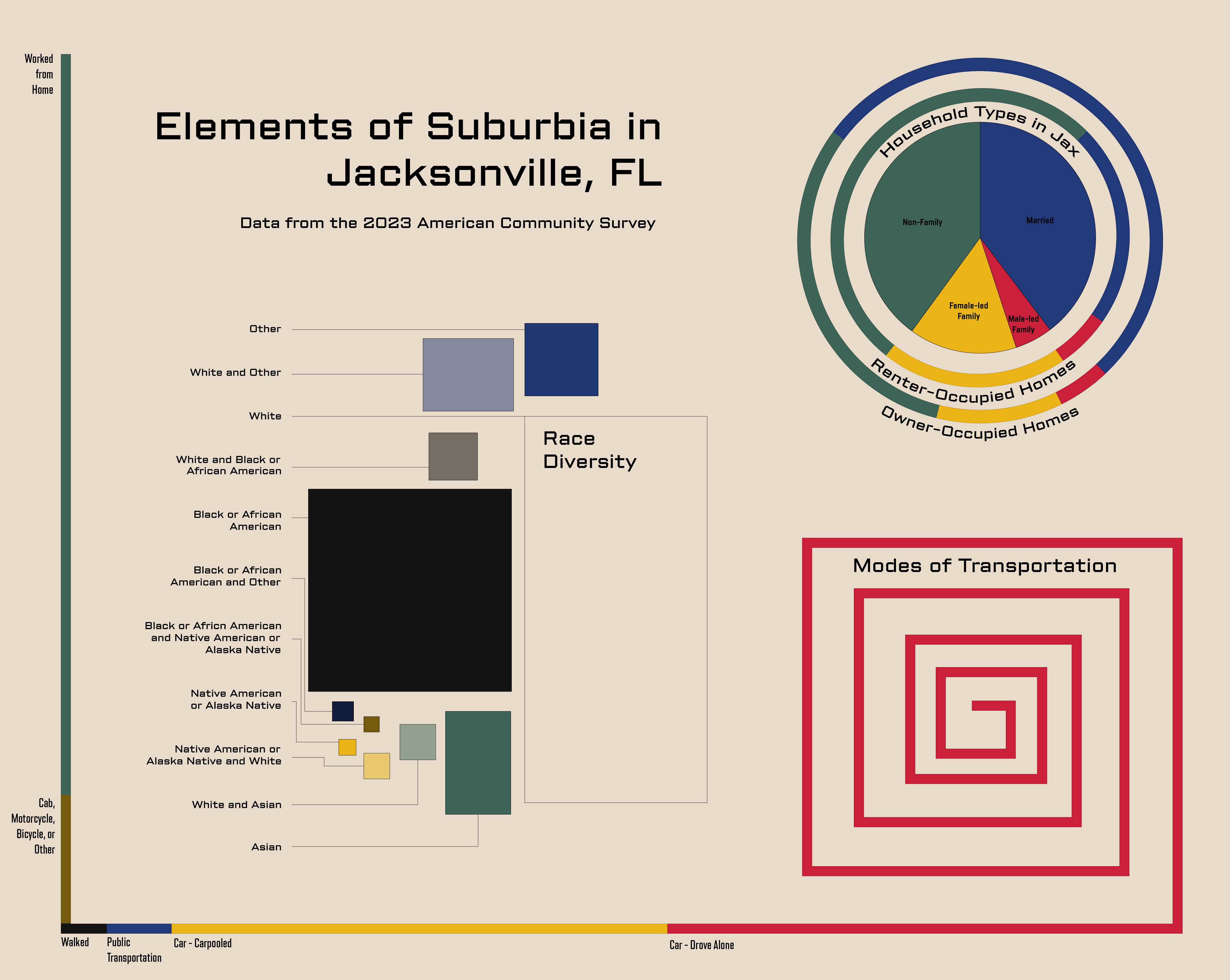
Race, Transportation, and Households across all of Jacksonville
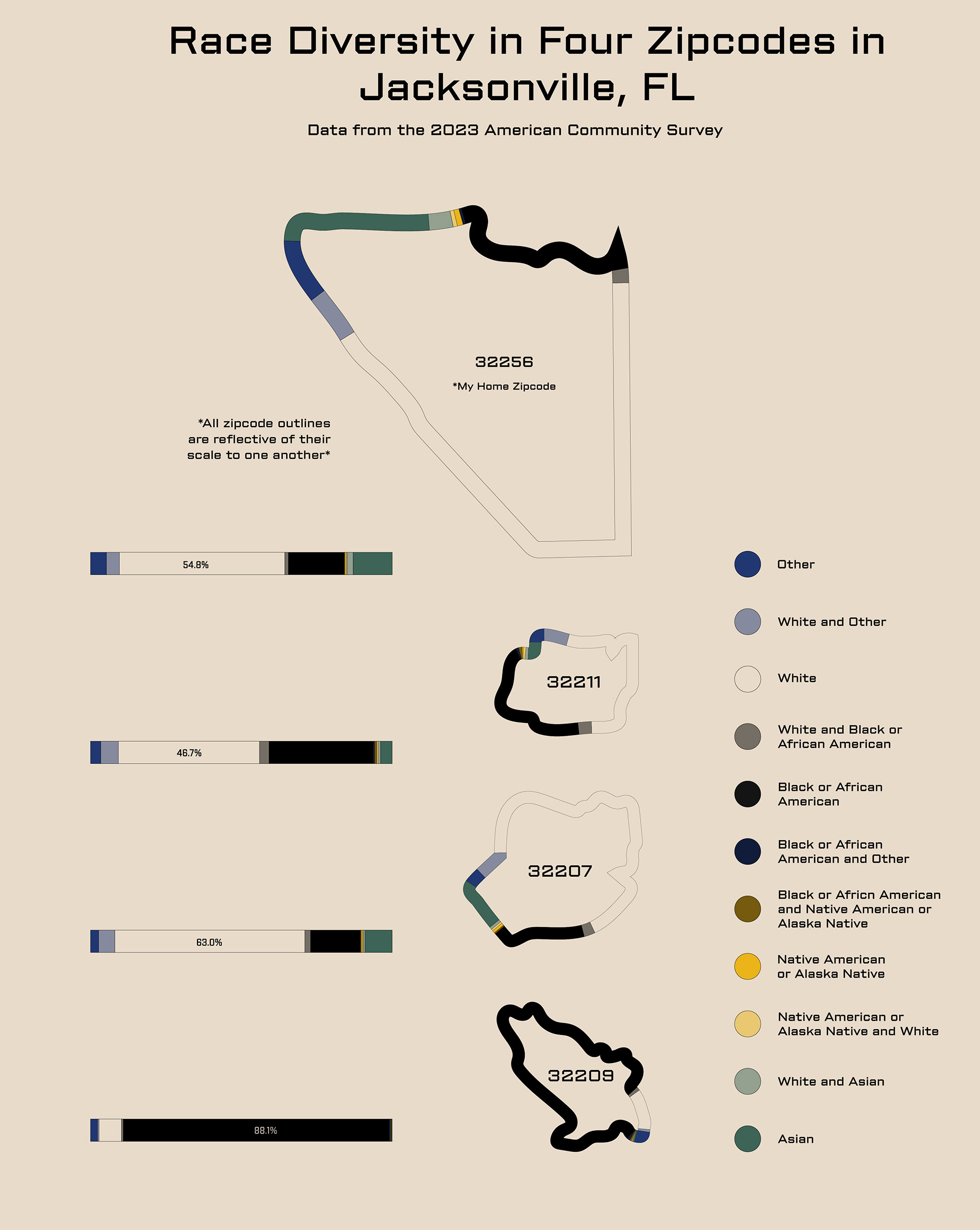
Racial Diversity within Four Zipcodes in Jacksonville
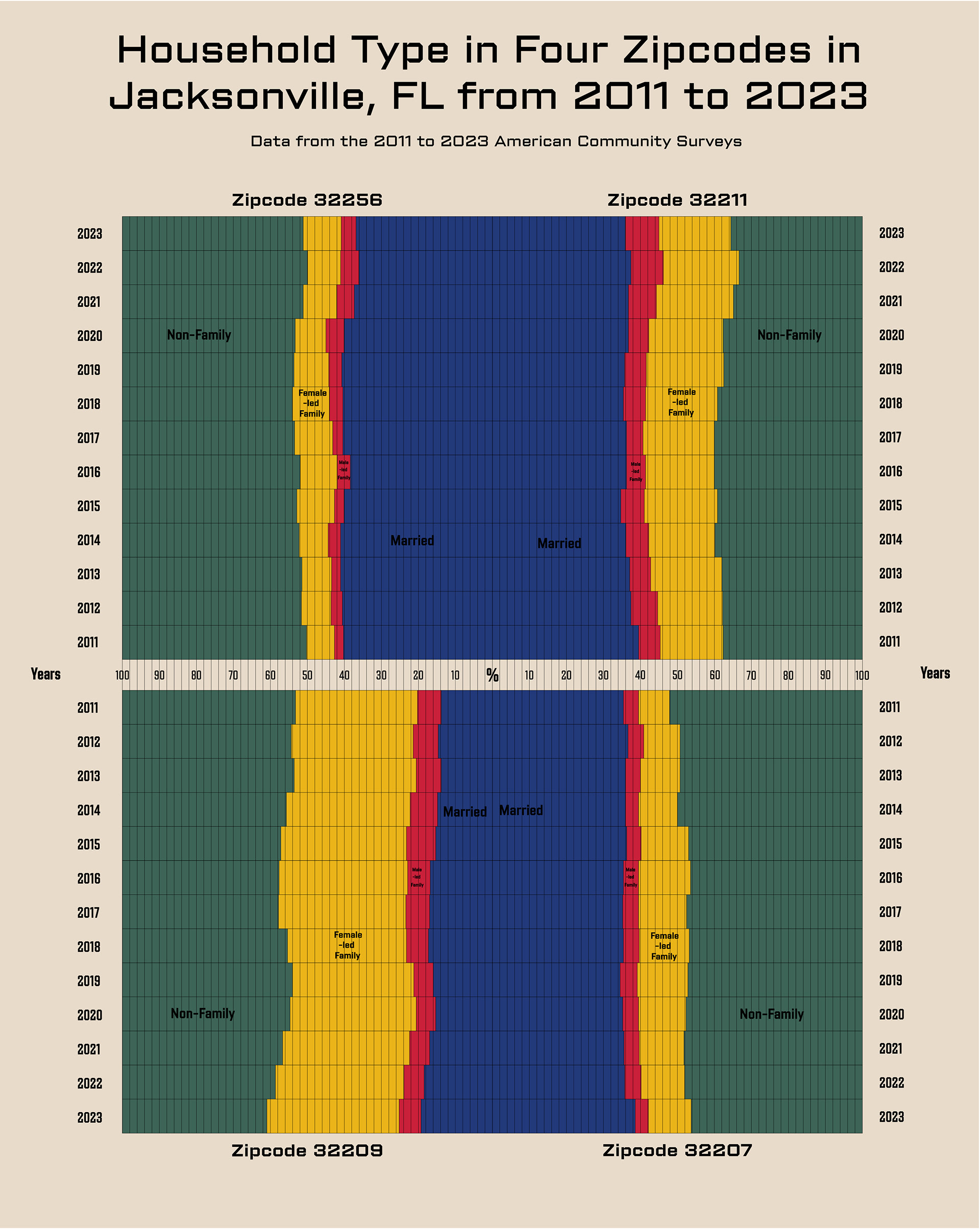
Household Types in Four Zipcodes of Jacksonville
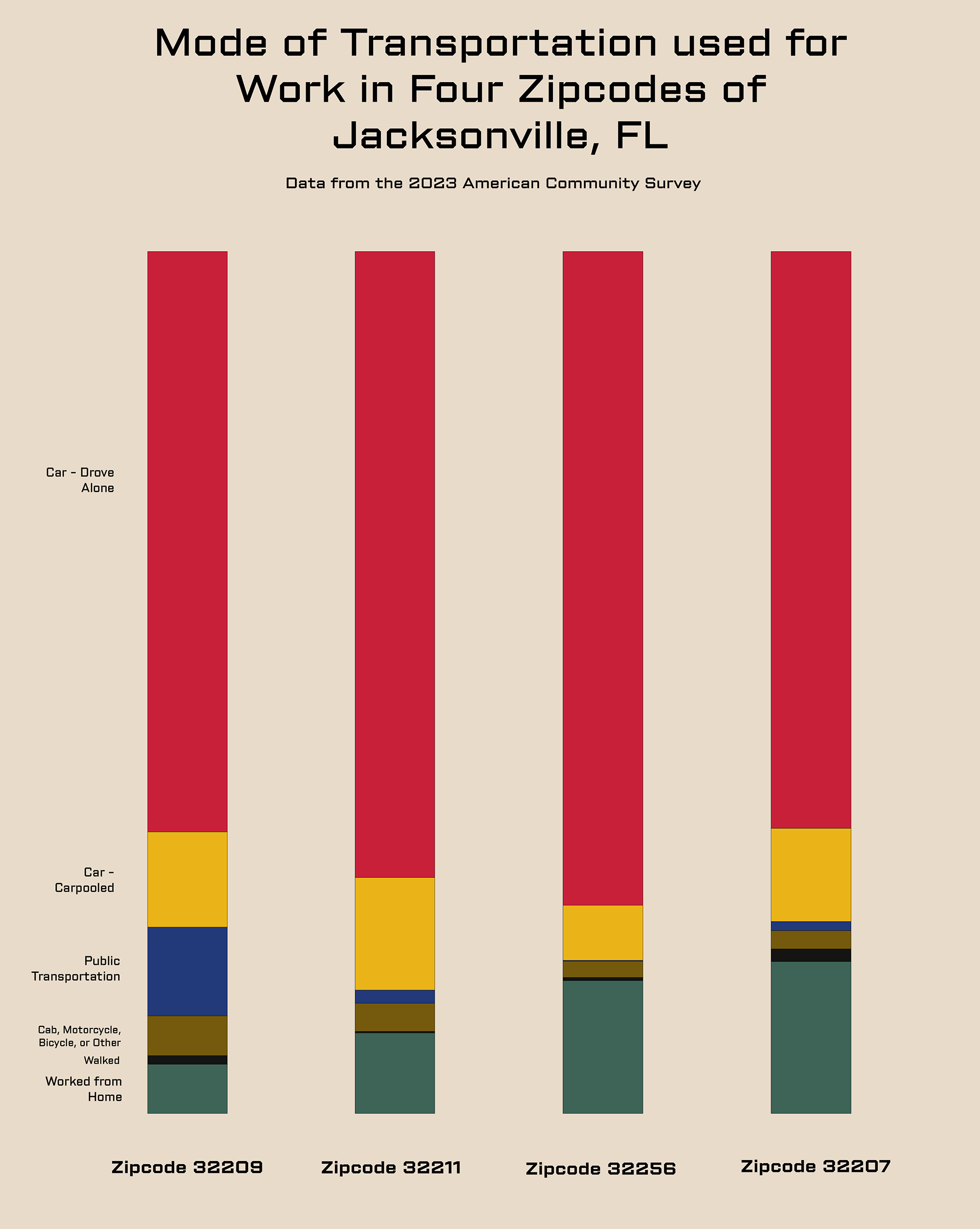
Modes of Transportation Used for Work in Four Zipcodes of Jacksonville
For the 1900 Paris Exposition W.E.B. Du Bois created two data visualization series that illustrated the lives and wealth of The Georgia Negro and The condition of the descendants of former African slaves now in residence in the US. Since learning about this work, Du Bois' work has largely influenced the way I approach data visualization. So when I wanted to visualize data about elements of suburbia in my hometown of Jacksonville, Florida, I felt compelled to use his work as stylistic inspiration. Not only because of my love for his work, but because of how connected Suburbia is to the post-emancipation politics and society that Du Bois was studying in 1900.
Overall, studying the distribution of race, transportation, and household types in my hometown was very informative to how I view the different areas of my city. I grew up in a very white, wealthy, car dependent zipcode of Jacksonville and the experience of going to New York for college made me especially aware of this. These visualizations are meant to illustrate the discriminative disparities that persist in suburban infrastructure.